http://earthobservatory.nasa.gov/NaturalHazards/view.php?id=52052
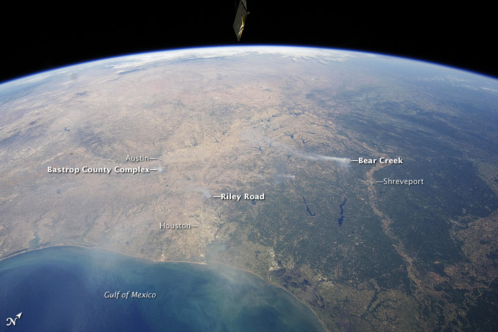
This is an image that I found off of the NASA website that I found cool, although it was taken September 7, but it shows the smoke that you can see from space from fires taking place in Texas. This was an event that I never knew was going on but find it important to know about especially since it's been so dry down there lately.
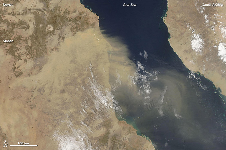
This is a picture from the same website that again shows another area that is being affected by drought, showing the dust bowl flowing over the red sea. This website is really good because once again I had no idea of much of the things going on in the world because you don't hear about areas like this, however, they are being devastated by these hazards/disasters.
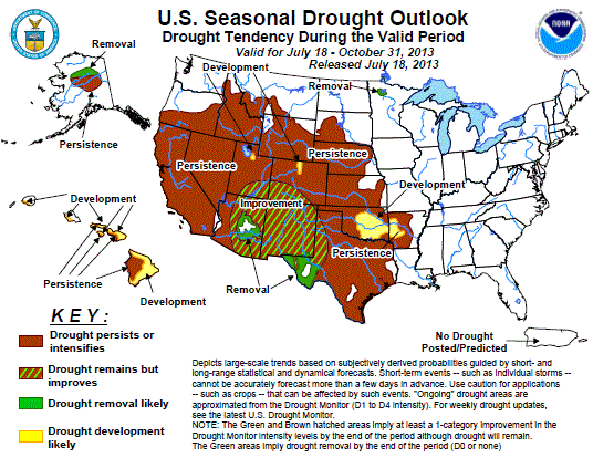
This is from http://www.cpc.ncep.noaa.gov/products/expert_assessment/seasonal_drought.html and it displays the U.S. seasonal drought outlook which has been as bad as ever. You can see that the south and even areas in the midwest are showing that their current drought situation is going to persist or intensify.

This is an image I took from http://graphical.weather.gov/ and it shows the high temperatures for today's date (10-4) and you can see how abnormally high temperatures are in the midwest down through Texas and east to Florida. Some of these areas have been in their longest droughts in history and have had wildfire outbreaks and with these high temperatures all over, they may both continue.

This image shows landslide sucseptibility of areas on the East coast, especially in the Appalachian Mountain region. The red areas are the places most prone to slope failure.

